SPW Surveying

Accurate information for confident decisions.

Professional surveying, mapping and geospatial services for property, design, engineering and construction projects across Trinidad & Tobago.

Surveying Services Boundary • Topographic • GNSS • LiDAR • Hydrographic • Setting-Out
Core Services

Surveying built around the project.

From defining property boundaries to supplying design levels and construction control, each service is structured around the information the next project stage needs.

Land & Cadastral Surveying
SPW SURVEYING
01

Land & Cadastral Surveying

Boundary definition, property surveys and cadastral support for ownership, development and subdivision.

  • Boundary definition & re-establishment
  • Subdivision surveys
  • Cadastral mapping
  • Survey data & plan preparation
View service →
Topographic Surveys
SPW SURVEYING
02

Topographic Surveys

Detailed mapping of existing ground, structures and features for design, planning and engineering.

  • Spot levels & contours
  • Structures, utilities & drainage
  • Profiles & cross-sections
  • Digital terrain/surface models
View service →
Construction Setting-Out
SPW SURVEYING
03

Construction Setting-Out

Field setting-out and dimensional control for buildings, roads, drainage and civil works.

  • Building grids & foundations
  • Road and drainage alignments
  • Levels, offsets & control points
  • As-built verification
View service →
GNSS / GPS Surveys
SPW SURVEYING
04

GNSS / GPS Surveys

High-precision positioning, RTK observations and control surveys for engineering and property projects.

  • RTK positioning
  • Survey control networks
  • Coordinate establishment
  • Engineering support
View service →
Drone Mapping, LiDAR & 3D Scanning
SPW SURVEYING
05

Drone Mapping, LiDAR & 3D Scanning

Modern aerial and 3D capture for mapping, terrain modeling, site documentation and volumetric work.

  • Orthophoto mapping
  • Point clouds & 3D capture
  • Terrain/surface models
  • Volumes & site documentation
View service →
Hydrographic & Bathymetric Surveys
SPW SURVEYING
06

Hydrographic & Bathymetric Surveys

Depth and water-body surveying for channels, rivers, coastal works and infrastructure projects.

  • Channel cross-sections
  • Bed levels & depths
  • Watercourse mapping
  • Engineering survey support
View service →
Road & Engineering Surveys
SPW SURVEYING
07

Road & Engineering Surveys

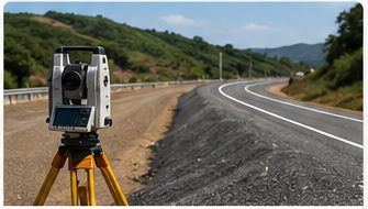
Survey information for roadway, drainage and infrastructure design, construction and rehabilitation.

  • Longitudinal profiles
  • Cross-sections
  • Alignment/control
  • As-built & construction surveys
View service →
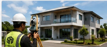
Surveyor carrying out an as-built survey beside a completed building
SPW SURVEYING
08

As-Built Surveys

Field verification of completed or existing works to record their actual position, dimensions and levels.

  • Building footprints & structural positions
  • Roads, drainage & utility features
  • Finished levels & elevations
  • Design-to-construction verification
View service →
Field to Final Deliverable

Reliable survey information from capture to drawing.

SPW combines field observations, control, data processing and CAD deliverables to produce information that can be used confidently for design, engineering and construction.

01Review the RequirementProperty, design, engineering or construction objective.
02Establish ControlCoordinate and level framework suited to the project.
03Capture Field DataTotal station, GNSS, drone, LiDAR or hydrographic methods as required.
04Process & CheckQA, calculations, surfaces, linework and survey verification.
05DeliverPlans, coordinates, profiles, cross-sections, models or setting-out information.
Need a survey?

Tell us what you are planning and where the site is located.

We can help identify the survey information needed for property, design, engineering or construction work.